DJI Enterprise Technology
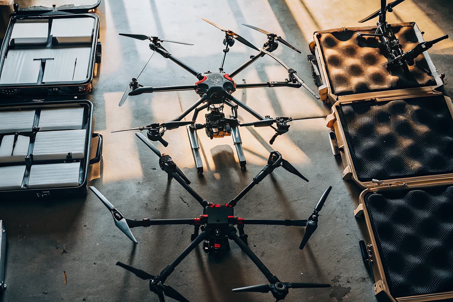
Our Equipment & Fleet
DSCR operates exclusively with DJI Enterprise platforms — the same hardware used by government agencies, engineering firms, and Fortune 500 companies worldwide. Every platform is flown by DGAC-certified pilots with mission-specific training.
The Fleet
DJI Enterprise Platforms & Payloads
Eight specialized systems covering every professional drone use case, from centimeter-accurate LiDAR surveying to autonomous agricultural operations.
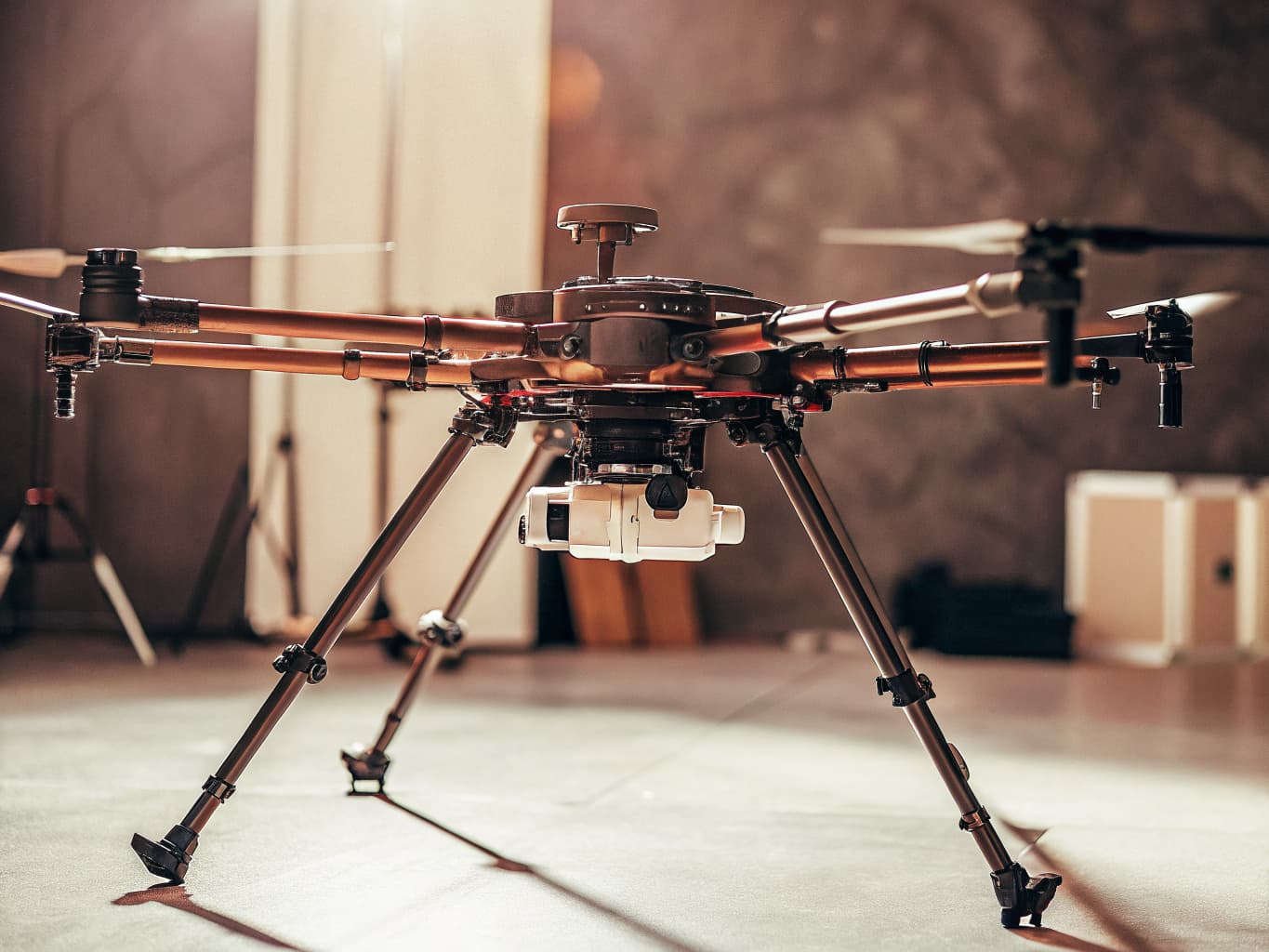
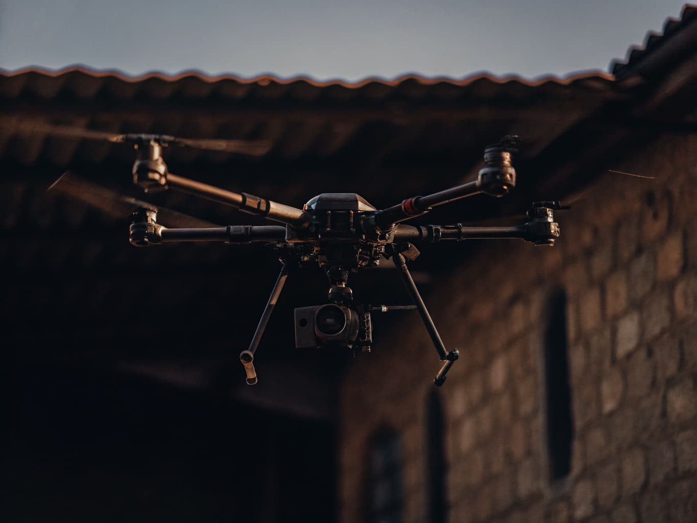
Flagship Survey & Inspection Platform
DJI Matrice 350 RTK
The DJI Matrice 350 RTK is the gold standard for enterprise drone operations and DSCR's primary platform for mapping, inspection, security, and enterprise missions. Its tri-redundant flight controller, IP55 weather resistance, and 55-minute maximum flight time make it deployable in Costa Rica's unpredictable tropical weather conditions — from morning fog in the Central Valley to afternoon Pacific squalls.
| Specification | Value |
|---|---|
| Max Flight Time | 55 min (single battery) |
| Max Wind Resistance | 12 m/s |
| RTK Positioning | Horizontal: 1cm + 1ppm, Vertical: 1.5cm + 1ppm |
| Video Transmission | O3 Enterprise — 15km HD video link |
| Obstacle Sensing | 6-directional, active safety |
| IP Rating | IP55 dust and water resistance |
| Payload Capacity | 2.7 kg single gimbal / 2.4 kg dual |
| Compatible Payloads | Zenmuse L2, L3, P1, H20T, X7, X9 |
Legacy & Payload Compatibility Platform
DJI Matrice 300 RTK
The DJI Matrice 300 RTK remains in the DSCR fleet for projects requiring specific legacy payload compatibility or dual-operator workflows. It shares the same RTK precision positioning as the M350 and supports up to three simultaneous payloads, making it ideal for complex multi-sensor inspection missions where visible, thermal, and LiDAR data must be captured in a single pass.
| Specification | Value |
|---|---|
| Max Flight Time | 55 min |
| Payload Configuration | Up to 3 simultaneous payloads |
| RTK Positioning | Horizontal: 1cm + 1ppm |
| IP Rating | IP45 |
| Video Transmission | OcuSync Enterprise — 15km range |
| Max Speed | 23 m/s |
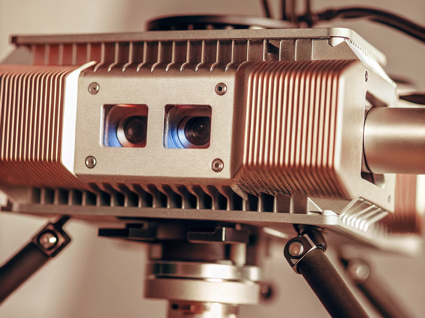
Aerial LiDAR Payload
DJI Zenmuse L2
The DJI Zenmuse L2 is DSCR's primary LiDAR payload, integrating a high-accuracy LiDAR module, an RGB mapping camera, and a high-precision IMU into a single system. It captures up to 240,000 points per second with 5-return support, allowing it to penetrate Costa Rica's dense forest canopy and deliver accurate ground models even through heavy vegetation cover.
| Specification | Value |
|---|---|
| Point Rate | Up to 240,000 pts/sec |
| Detection Range | 3m to 1,500m |
| Returns | 5 returns per pulse |
| Accuracy | Vertical: 2cm, Horizontal: 5cm at 150m |
| IMU Accuracy | Pitch/Roll: 0.05°, Yaw: 0.15° |
| RGB Camera | 4/3 CMOS, 20MP |
| Weight | 905g |
Next-Gen LiDAR Payload
DJI Zenmuse L3
The DJI Zenmuse L3 pushes LiDAR performance further with higher point density, improved canopy penetration, and a larger field of view. For Costa Rica's complex tropical terrain — where archaeological sites, pipeline corridors, and agricultural land are often concealed beneath dense triple-canopy forest — the L3's enhanced penetration capability delivers ground models that the L2 alone cannot achieve.
| Specification | Value |
|---|---|
| Point Rate | Up to 1,000,000 pts/sec (dual returns) |
| Detection Range | 3m to 1,500m |
| FOV | 360° horizontal, 75° vertical |
| Returns | Up to 5 returns per laser pulse |
| RGB Camera | 4/3 CMOS, 20MP for colorized point clouds |
| Best Use | Dense vegetation, complex terrain, high-density urban surveys |
Photogrammetry Payload
DJI Zenmuse P1
The DJI Zenmuse P1 equips the Matrice 350 RTK with a full-frame 45-megapixel Sony sensor and three interchangeable prime lenses (24mm, 35mm, 50mm). For orthomosaic mapping, photogrammetric reconstruction, and detailed property documentation, the P1 captures imagery at ground sampling distances as fine as 2.5cm at 100m altitude — ideal for cadastral surveys, construction progress tracking, and high-resolution site documentation across Costa Rica.
| Specification | Value |
|---|---|
| Sensor | 45MP full-frame CMOS (35.9×24mm) |
| Lens Options | 24mm f/2.8, 35mm f/2.8, 50mm f/2.8 |
| GSD at 100m | 2.5cm (35mm lens) |
| Gimbal | 3-axis stabilization |
| Aerial Coverage | ~3 km² per battery (at 160m altitude) |
| Shutter | Global electronic shutter — zero motion blur |
Thermal + Zoom Multi-Sensor Payload
DJI Zenmuse H20T
The DJI Zenmuse H20T is DSCR's primary payload for security, infrastructure inspection, and search operations. It integrates four sensors into one gimbal: a 20MP wide-angle camera, a 23MP zoom camera (200× hybrid), a laser rangefinder accurate to ±0.2m, and a 640×512 radiometric thermal imager. In security applications, the thermal channel detects human and vehicle heat signatures at ranges exceeding 1,000 meters — even through darkness, smoke, and light rain.
| Specification | Value |
|---|---|
| Wide Camera | 20MP, 82.9° FOV |
| Zoom Camera | 23MP, 200× hybrid zoom (16× optical + digital) |
| Thermal | 640×512px, 30Hz, NETD ≤50mK |
| Laser Rangefinder | 3m–1200m range, ±0.2m accuracy |
| Operating Temperature | -20°C to 50°C |
| Thermal Sensitivity | ≤50mK — detects subtle temperature differences |
Precision Agriculture Platform
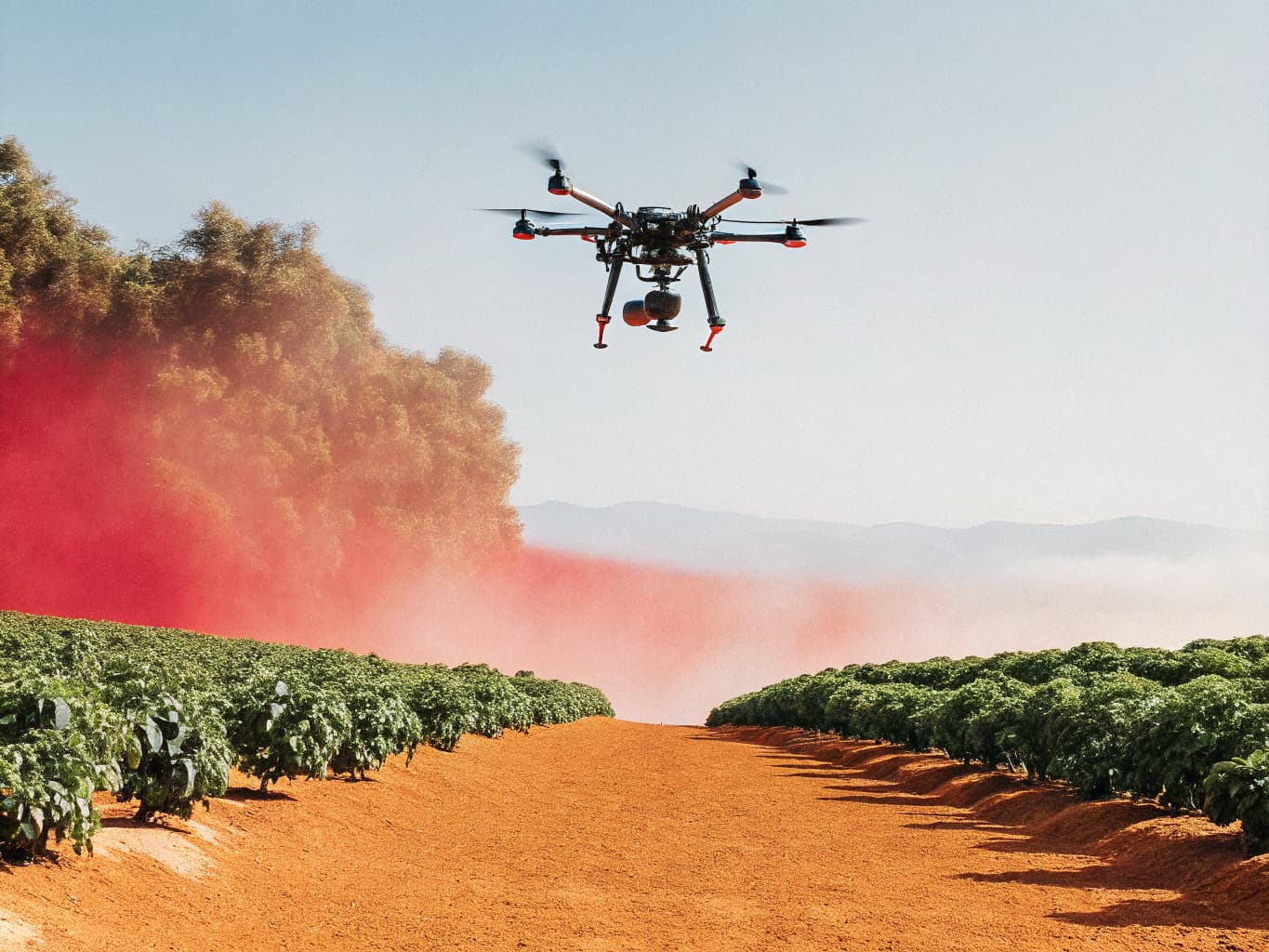
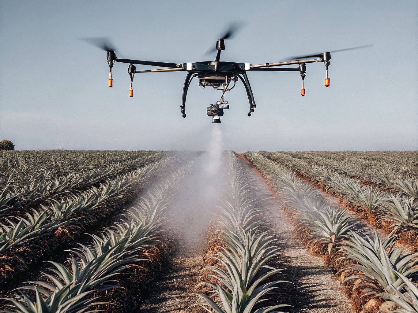
DJI Agras T40
The DJI Agras T40 is the most capable agricultural spraying drone in the DJI lineup, and DSCR's platform of choice for precision agriculture operations across Costa Rica's diverse crop types. Its 40-liter tank, 8 atomized nozzles, and terrain-following radar enable consistent spray coverage on sloped, irregular, and obstacle-dense farmland that conventional ground equipment cannot access efficiently.
| Specification | Value |
|---|---|
| Tank Capacity | 40L spray / 50L spreading |
| Spray Nozzles | 8 atomized nozzles, 9m effective swath |
| Coverage Rate | Up to 40 hectares/hour (spraying mode) |
| Terrain Following | Radar-based, 1–30m operating altitude |
| Operation Modes | Manual, autonomous route, remote-sensing guided |
| Compatible Data | DJI SmartFarm variable-rate prescription maps |
Used In
Autonomous Operations Station
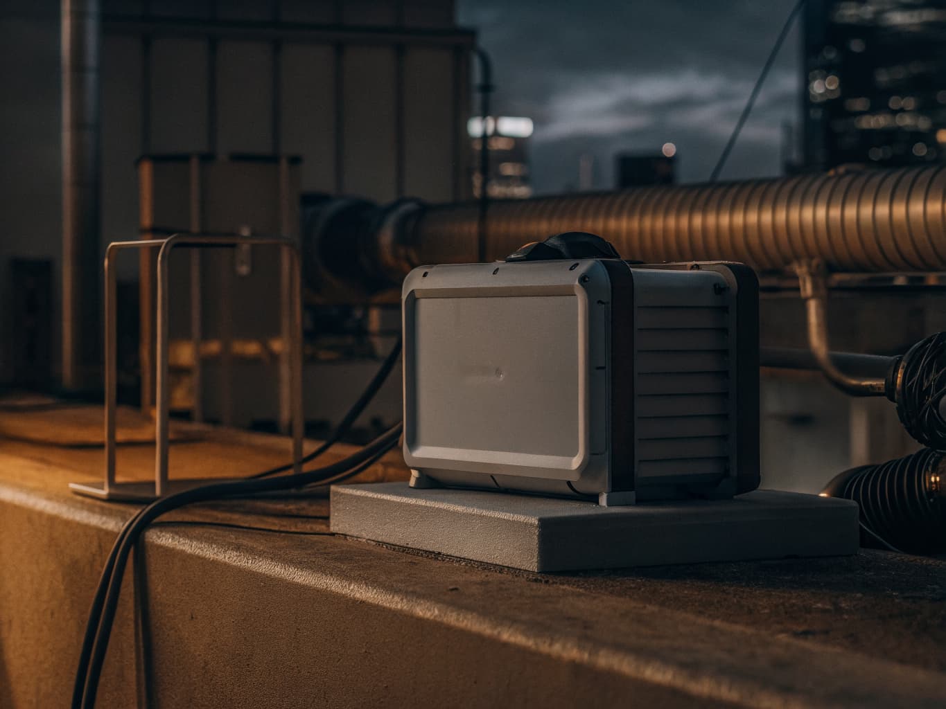
DJI Dock 2
The DJI Dock 2 enables fully autonomous drone operations without an on-site pilot — a capability that transforms how enterprises in Costa Rica manage recurring aerial missions. The weatherproof station handles automated landing, battery charging, and environmental protection for the Matrice 350 RTK. Missions are dispatched, monitored, and analyzed entirely through DJI FlightHub 2 from any location in the world.
| Specification | Value |
|---|---|
| Compatible Aircraft | DJI Matrice 350 RTK |
| Charging Time | <25 minutes to full charge |
| IP Rating | IP55 — full weather protection |
| Operating Temperature | -35°C to 50°C |
| Remote Management | DJI FlightHub 2 cloud platform |
| Connectivity | 4G LTE, optional Wi-Fi |
| Power Requirements | AC 100–240V, 20A dedicated circuit |
The DSCR Standard
Why DJI Enterprise — Not Consumer Drones
The gap between a consumer DJI Phantom and a DJI Matrice 350 RTK isn't a matter of price — it's a matter of data quality, operational reliability, and the payload ecosystem. Consumer drones produce data that's good enough for a social media post. Enterprise equipment produces data that engineers sign off on, courts accept as evidence, and government agencies use for official cadastral records.
DSCR made a deliberate decision to operate exclusively with DJI Enterprise hardware because our clients don't have room for ambiguity. A survey that's off by 15cm costs a developer millions. A missed thermal anomaly on a power line costs a utility a major outage. The right equipment isn't a luxury — it's a professional requirement.
1–2 cm
RTK Accuracy
Horizontal positioning
1,500 m
LiDAR Range
Zenmuse L2/L3
55 min
Flight Time
Matrice 350 RTK
≤50 mK
Thermal NETD
Zenmuse H20T
Ready to Put This Technology to Work?
Tell us about your project and we'll recommend the right platform and payload combination.