DJI Enterprise · DGAC Certified · Costa Rica
Professional Drone Services
Eight specialized drone service lines, each delivered with DJI Enterprise hardware operated by DGAC-certified pilots. From centimeter-accurate LiDAR mapping to autonomous 24/7 security operations with DJI Dock 2 — DSCR delivers the data and imagery that drive real decisions.
Equipment Used
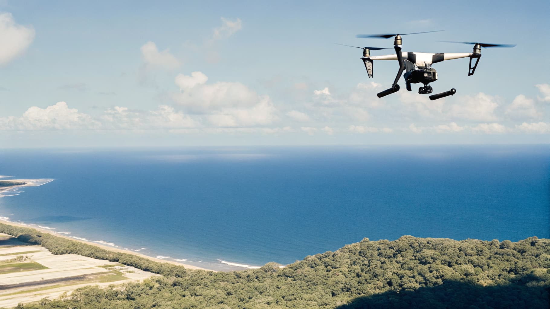
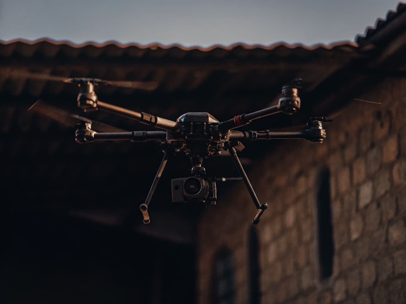
- DJI Matrice 350 RTK — O3 Enterprise transmission, 55-minute flight time, IP55 weather resistance
- DJI Zenmuse P1 — 45MP full-frame sensor, 3 interchangeable prime lenses, 2.5cm GSD at 100m
- DJI Zenmuse L2 — 5-return LiDAR, 0.2° accuracy, 1500m range, real-time colorized point cloud
- DJI Zenmuse L3 — Next-gen LiDAR with enhanced point density for complex canopy penetration
Drone Mapping & Aerial Survey
DSCR's drone mapping service delivers centimeter-level spatial accuracy for any terrain in Costa Rica. Powered by the DJI Matrice 350 RTK combined with the Zenmuse P1 full-frame photogrammetry payload or the Zenmuse L2/L3 LiDAR sensors, we capture the kind of precision data that drives confident engineering, planning, and investment decisions.
How DSCR Delivers It
Every mapping mission begins with a detailed flight plan calibrated to your accuracy requirements, site size, and terrain complexity. The Matrice 350 RTK uses onboard RTK/PPK positioning to eliminate the need for excessive ground control points, slashing field time without sacrificing accuracy. The Zenmuse P1 captures 45-megapixel full-frame imagery at 2.5cm/pixel resolution, while the Zenmuse L2/L3 LiDAR scans at up to 240,000 points per second with a range exceeding 1,500 meters — ideal for Costa Rica's dense forest canopy where traditional photogrammetry can't penetrate the tree cover.
Deliverables
- ✓Orthomosaic maps (GeoTIFF, 2–5cm/pixel)
- ✓Digital Elevation Models (DEM) and Digital Surface Models (DSM)
- ✓Classified LiDAR point clouds (LAS/LAZ format)
- ✓3D mesh models (OBJ, FBX, 3D Tiles)
- ✓Ground Sampling Distance reports and accuracy certificates
- ✓AutoCAD DWG and Esri Shapefile exports
Costa Rica Use Cases
In Costa Rica, DSCR mapping missions cover land subdivision in the Central Valley, coffee and pineapple plantation boundary surveys in Guanacaste, pre-construction topo surveys in Alajuela and Heredia, and forest carbon stock assessments in protected areas of the Caribbean slope. Our data integrates directly into AutoCAD Civil 3D, Esri ArcGIS, QGIS, and DroneDeploy platforms.
Equipment Used
- DJI Matrice 350 RTK — ultra-stable 6-axis gimbal isolation, O3 Enterprise 15km range
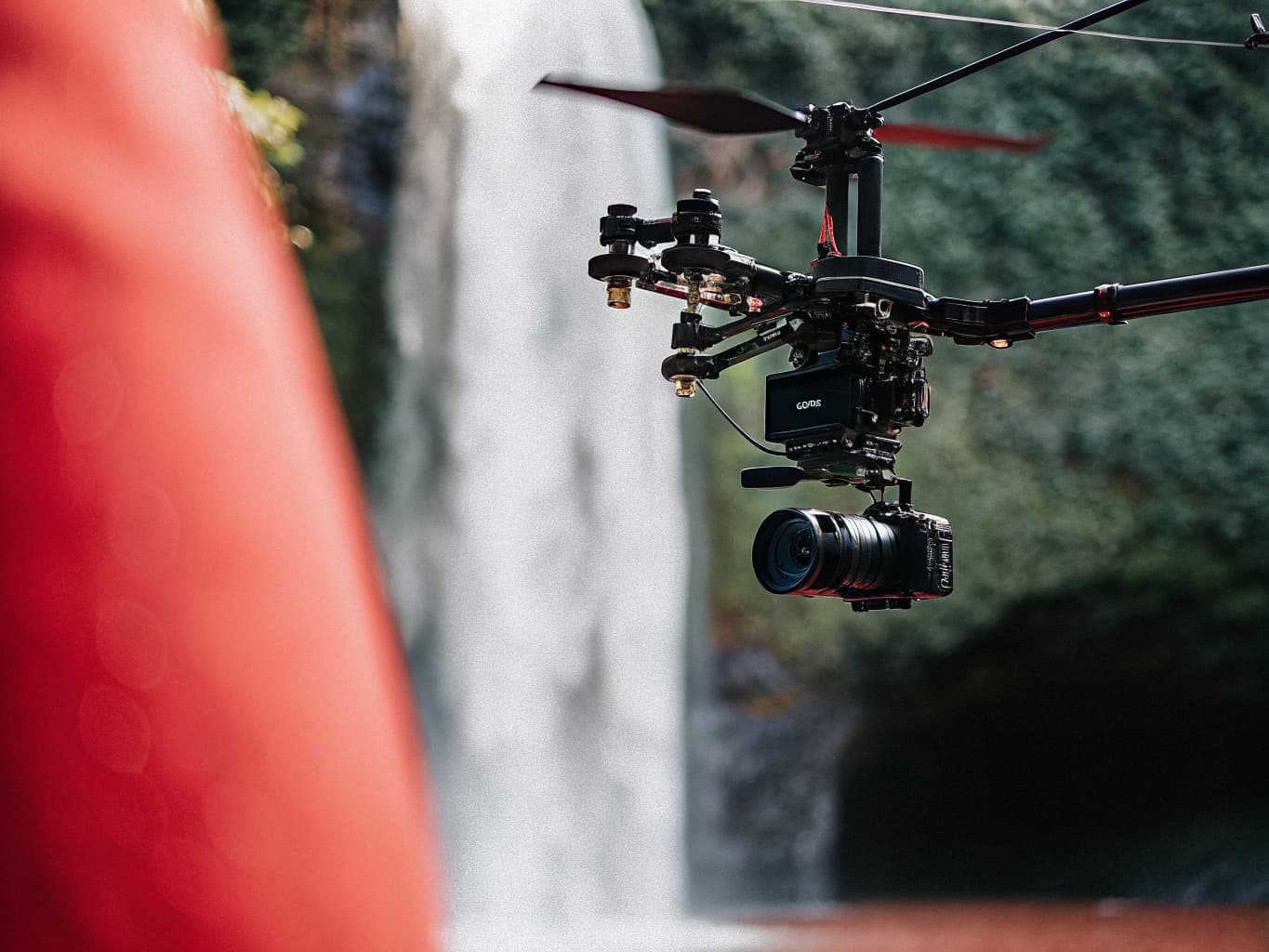
- Cinema-grade 6K camera payloads — up to 50MP stills and 6K/30fps video
- Variable ND filters for optimal exposure in Costa Rica's bright tropical light
- DJI RC Plus controller with 7" 1000-nit display for sunny outdoor monitoring
Cinematic Drone Video Production
DSCR's aerial videography service puts Costa Rica's spectacular landscapes on screen with the technical quality demanded by broadcast, luxury real estate, and global tourism marketing. Operating the DJI Matrice 350 RTK with cinema-grade stabilized camera systems, we deliver footage that no ground-based or helicopter production can match for cost, safety, and creative flexibility.
How DSCR Delivers It
Pre-production starts with a creative brief, location scouting, and airspace authorization through DGAC. Our pilots use the DJI RC Plus controller with real-time 4K HD video downlink to monitor composition in real time, making creative adjustments on the fly. We leverage RTK waypoint automation for repeatable tracking shots, and manual control for dynamic reveals. Post-production includes color grading, stabilization, and delivery in your required format — 4K ProRes, H.264, or H.265.
Deliverables
- ✓4K or 6K aerial footage, color-graded and stabilized
- ✓Edited promotional video cuts (30s, 60s, 90s, full-length)
- ✓High-resolution aerial stills for print and digital use
- ✓Raw ungraded footage archive on request
- ✓Social media optimized vertical/square cuts
Costa Rica Use Cases
DSCR aerial video productions span luxury real estate listings in Santa Teresa and Escazú, eco-lodge and resort marketing in Manuel Antonio and Arenal, adventure tourism content in Monteverde and Tortuguero, and corporate communications for major Costa Rican enterprises. We also support international documentary and film productions requiring DGAC-permitted aerial units in Costa Rica.
Equipment Used
- DJI Matrice 350 RTK — IP55 weather resistance, night navigation lights, 55-minute endurance
- DJI Zenmuse H20T — 20MP wide camera + 200× hybrid zoom + laser rangefinder + 640×512 thermal
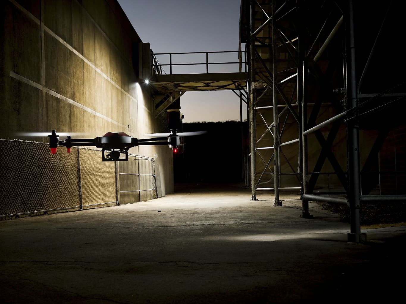
- DJI Dock 2 — autonomous launch/landing/charging station for unmanned 24/7 operations
- Encrypted O3 Enterprise video link — 15km range, AES-256 data security
Drone Security & Perimeter Surveillance
Modern perimeter security requires coverage that static cameras and ground patrols cannot provide cost-effectively. DSCR deploys the DJI Matrice 350 RTK equipped with the Zenmuse H20T — a quad-sensor payload combining a 20MP wide camera, 200× hybrid zoom, laser rangefinder, and a 640×512 radiometric thermal imager — to detect, classify, and track intrusions across large properties in any lighting condition.
How DSCR Delivers It
Security missions are programmed as autonomous patrol routes that cycle through designated waypoints at preset intervals, streaming live multi-sensor video to your security operations center via secure encrypted links. The H20T's thermal imager detects human and vehicle heat signatures through darkness, smoke, and light vegetation. When an anomaly is detected, the system triggers alerts and can lock a zoom lens onto the target while the operator evaluates the threat and coordinates response. For high-value sites, we integrate the <strong>DJI Dock 2</strong> for fully automated, around-the-clock drone deployment without on-site pilot presence.
Deliverables
- ✓Live thermal + visible-light video stream to your security operations center
- ✓Event-triggered recording and alerting system
- ✓Geofenced patrol area with unauthorized entry detection
- ✓Post-incident thermal and visible-light footage archives
- ✓Regular patrol compliance reports
Costa Rica Use Cases
DSCR drone security deployments protect banana and pineapple plantations along the Caribbean coast, industrial parks in the Central Valley, private estates and haciendas in Guanacaste, and mining and energy infrastructure in remote areas of Costa Rica. The Zenmuse H20T's thermal capability is especially valuable in Costa Rica's humid, low-visibility environment where traditional cameras fail.
Equipment Used
- Professional terrestrial laser scanners — up to 500m range, <1mm accuracy at 10m
- DJI Zenmuse L2 & L3 — for hybrid aerial + ground combined missions
- Total station and GNSS integration for georeferencing
- Photogrammetry registration for colorized point clouds
Ground LiDAR Scanning
While aerial LiDAR covers broad areas rapidly, terrestrial laser scanning (TLS) achieves a level of resolution and precision that aerial sensors cannot match for close-range structural and environmental applications. DSCR operates professional-grade ground LiDAR scanners capable of capturing tens of millions of data points per scan position, producing exact 3D replicas of structures, interiors, terrain, and vegetation with sub-centimeter accuracy.
How DSCR Delivers It
Ground LiDAR missions are planned with a network of scan positions to ensure complete coverage without shadowing. Each station is registered to its neighbors using targets or cloud-to-cloud matching, then the entire dataset is georeferenced to real-world coordinates using GNSS. For projects requiring both macro-scale coverage and micro-scale detail, DSCR combines aerial LiDAR from the <strong>DJI Zenmuse L2/L3</strong> with ground TLS to create a seamless multi-scale 3D model — an approach frequently used for as-built documentation of complex engineering structures.
Deliverables
- ✓Registered and georeferenced 3D point clouds (LAS/LAZ/E57)
- ✓Colorized point cloud models from integrated photography
- ✓BIM-ready as-built drawings from scan-to-BIM processing
- ✓Cross-sections, floor plans, and elevations from scan data
- ✓Clash detection reports for engineering review
- ✓Heritage documentation at archive quality
Costa Rica Use Cases
Ground LiDAR scanning by DSCR has supported pre-renovation surveys of colonial architecture in Cartago and San José, as-built documentation for industrial facility expansions in Alajuela, structural assessment of bridges along the Pan-American Highway, and archaeological site recording in protected zones of Costa Rica. Combined with our aerial drone mapping services, it enables complete digital twin creation of any site.
Equipment Used
- DJI Agras T40 — 40L tank, 8 atomized nozzles, terrain-following radar, 40 hectares/hour
- DJI Matrice 350 RTK + Multispectral payload — NDVI, NDRE, and chlorophyll index mapping
- Zenmuse P1 — high-resolution aerial imagery for field boundary mapping
- DJI Smart Farm platform — variable rate application planning and crop analytics
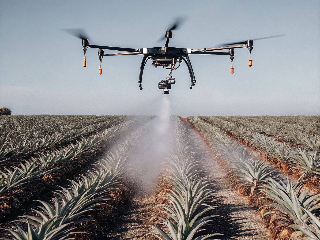
Agricultural Drones & Precision Farming
Costa Rica's agricultural sector — spanning pineapple, banana, coffee, palm oil, sugar cane, and ornamental crops — is under growing pressure to improve yield, reduce chemical input, and demonstrate environmental compliance. DSCR's agricultural drone program, powered by the DJI Agras T40, delivers precision spraying, multispectral crop health monitoring, and automated field mapping that transforms how Costa Rican growers manage their land.
How DSCR Delivers It
The DJI Agras T40 carries a 40-liter tank and a terrain-following radar system that maintains constant spraying height regardless of slope or obstacles — critical in Costa Rica's undulating volcanic terrain. Equipped with 8 atomized nozzles, it achieves a 9-meter swath per pass with droplet size precisely calibrated to the crop type and agrochemical being applied. Before each campaign, DSCR conducts an aerial NDVI (Normalized Difference Vegetation Index) survey using a multispectral sensor to generate a variable-rate application map — ensuring agrochemicals are only applied where needed, at the precise dose required.
Deliverables
- ✓NDVI and NDRE multispectral maps showing crop health zones
- ✓Variable-rate application prescriptions for precision spraying
- ✓Spray records with coverage maps and applied-volume logs
- ✓Field boundary and area measurement reports
- ✓Before/after comparison imagery for treatment evaluation
- ✓Agronomic recommendations based on remote sensing data
Costa Rica Use Cases
DSCR agricultural drone operations have covered pineapple plantations in the Caribbean lowlands, coffee fincas on the slopes of Barva and Poás volcanoes, banana production zones in Limón province, and palm oil operations in the South Pacific. The Agras T40 reduces agrochemical use by up to 30% through precision application, while spray consistency improves compared to ground-based methods on sloped terrain.
Equipment Used
- DJI Dock 2 — autonomous landing, charging, and environmental protection for 24/7 operations
- DJI Matrice 350 RTK — the dock-compatible enterprise platform for all payload types
- DJI FlightHub 2 — cloud-based fleet management, mission planning, and live operations
- Multiple Zenmuse payload options — L2/L3 LiDAR, P1, H20T — interchangeable per mission
- DJI Matrice 300 RTK — available for legacy payload compatibility
Enterprise Drone Deployment
For organizations that need ongoing, scalable drone operations rather than one-off missions, DSCR offers full Enterprise Drone Deployment programs. We design, implement, and manage end-to-end drone programs built around the DJI Matrice 350 RTK and DJI Dock 2 autonomous docking station — enabling organizations to run continuous, remotely-managed aerial operations without a permanent on-site pilot.
How DSCR Delivers It
Enterprise deployments begin with a program design phase: we assess your operational requirements, flight zones, data needs, and integration points, then architect a system that fits. The DJI Dock 2 is installed at your facility — it provides automated charging, storage, and launch/recovery for Matrice 350 RTK missions triggered remotely or on schedule. Missions can be dispatched from anywhere in the world via DJI FlightHub 2, with live 4K video, telemetry, and sensor data streamed in real time. DSCR manages initial configuration, DGAC regulatory compliance, and ongoing program oversight.
Deliverables
- ✓Fully configured autonomous drone operations infrastructure
- ✓DJI FlightHub 2 organization setup with user access management
- ✓Custom mission libraries for recurring flight tasks
- ✓DGAC compliance documentation and airspace authorizations
- ✓Operator training and program handover documentation
- ✓SLA-backed ongoing support and maintenance
Costa Rica Use Cases
DSCR enterprise deployments serve telecommunications providers monitoring tower infrastructure across Costa Rica, energy companies running transmission line patrol routes, logistics hubs requiring automated perimeter surveillance, and government agencies needing regular aerial coverage of critical assets. The DJI Dock 2 is particularly impactful in remote locations — eliminating the cost and safety risk of sending pilots to sites repeatedly.
Equipment Used
- DJI Matrice 350 RTK — consistent georeferenced data across repeat flights
- DJI Zenmuse P1 — 45MP orthomosaics and progress tracking at 2cm accuracy
- DJI Zenmuse H20T — thermal imaging for moisture, insulation, and structural defect detection
- DJI Terra — on-site processing for same-day orthomosaic delivery
Construction & Property Inspection
Construction projects move fast, and project managers need accurate, up-to-date information to keep them on track. DSCR's construction drone service provides regular aerial progress documentation, structural inspections, and property condition assessments using the DJI Matrice 350 RTK with photogrammetry and thermal payloads — giving project stakeholders a complete picture of site status from any device, anywhere.
How DSCR Delivers It
DSCR deploys on a scheduled basis — weekly, biweekly, or monthly — to capture orthomosaic maps of your site that can be overlaid on BIM models for plan-vs-actual comparison. The Matrice 350 RTK's RTK positioning ensures each flight is georeferenced to the same coordinate system, making time-lapse comparisons accurate down to centimeters. For structural inspections, we mount the <strong>Zenmuse H20T</strong> thermal + zoom payload to detect subsurface moisture, rebar heat patterns, and insulation defects invisible to the naked eye. Property pre-purchase inspections include roof condition, facade crack detection, and drainage analysis — all completed safely from the air.
Deliverables
- ✓Georeferenced orthomosaic maps showing progress against baseline
- ✓Volume calculations for earthworks, stockpiles, and cut/fill analysis
- ✓Thermal inspection reports with annotated defect locations
- ✓Photo-documented punch lists for QA/QC workflows
- ✓3D models and as-built documentation for the permanent record
- ✓BIM integration packages (Revit, IFC, Navisworks compatible)
Costa Rica Use Cases
DSCR construction drone surveys support residential and commercial development projects across San José, Alajuela, and Heredia provinces. Tourism resort construction in Guanacaste uses our weekly progress mapping to keep offshore investors informed. Pre-purchase property inspections in coastal communities like Tamarindo, Jacó, and Puerto Viejo identify structural issues that ground inspections miss, protecting buyers and banks from unforeseen risks. See also: Infrastructure Inspection for bridge and road asset monitoring.
Equipment Used
- DJI Matrice 350 RTK — 6-directional obstacle sensing, RTK accuracy for precise asset approach
- DJI Zenmuse H20T — 200× hybrid zoom for standoff inspections + thermal for hotspot detection
- DJI Zenmuse L2 — LiDAR point cloud for structural deformation and clearance measurement
- DJI RC Plus — 15km O3 Enterprise link with 4K live video for remote operations
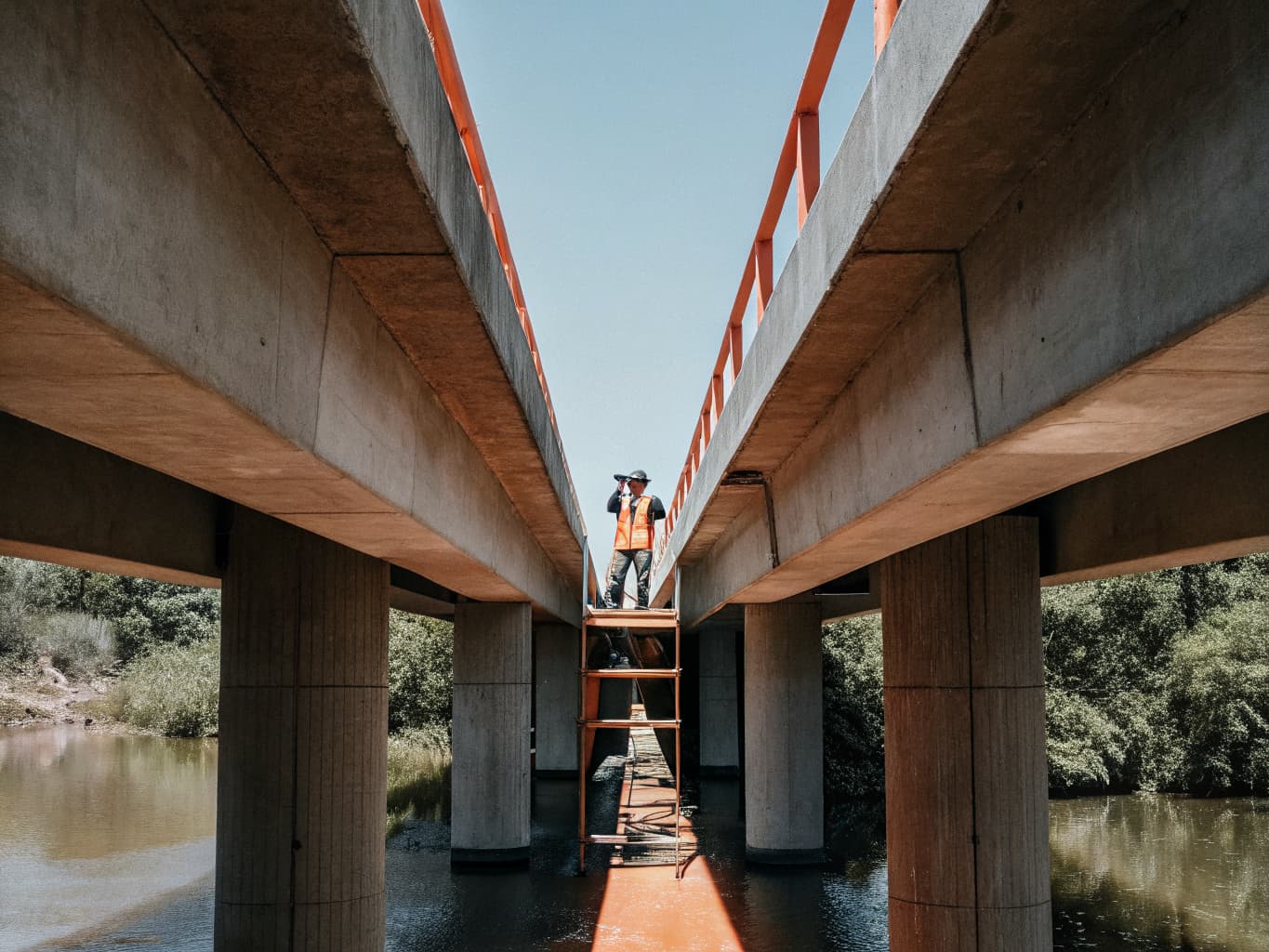
Infrastructure Inspection
Critical infrastructure — power transmission lines, bridges, dams, pipelines, and telecommunications towers — requires regular inspection that has historically exposed maintenance crews to serious height and access risks. DSCR's DJI Matrice 350 RTK eliminates that risk entirely, delivering close-range HD, zoom, and thermal imagery from the most challenging vantage points with zero scaffolding, rope access, or lane closures.
How DSCR Delivers It
Infrastructure inspections are planned with precise GPS waypoints and safe standoff distances specific to the asset type. For power lines, the Matrice 350 RTK uses Obstacle Sensing to navigate safely within 5 meters of energized conductors while the <strong>Zenmuse H20T</strong> captures thermal data for hotspot detection — identifying failing insulators and conductor connections before they cause outages. Bridge inspections combine visible-light imagery at 200× zoom for surface crack detection with thermal scanning for subsurface delamination. All findings are geo-tagged and compiled into annotated reports with severity ratings and recommended remediation timelines.
Deliverables
- ✓Geo-tagged photo and video inspection records
- ✓Annotated inspection report with asset condition ratings
- ✓Thermal anomaly maps with temperature data for energy assets
- ✓LiDAR point cloud for structural deformation analysis
- ✓Executive summary and prioritized maintenance recommendations
- ✓Historical comparison reports for trend analysis on repeat inspections
Costa Rica Use Cases
DSCR infrastructure inspection operations cover ICE electrical transmission lines across Costa Rica's rugged terrain, bridges along the Pan-American Highway and Route 27, telecom tower networks operated by Claro, Movistar, and Liberty, and oil pipeline infrastructure in the Limón refinery corridor. Our inspection data has reduced the average time to detect and repair critical infrastructure defects by identifying issues that ground-based visual inspections consistently miss. See also: Construction & Property Inspection.
Ready to Deploy Costa Rica's
Most Advanced Drone Fleet?
Our team will review your project requirements and recommend the optimal platform, payload, and mission profile. All consultations are free.